
Cyclone ‘Arnab’ threat: Which states will be affected as Bay of Bengal weather system nears coast | India News
Cyclone ‘Arnab’ updates: A deep depression will cross the north Andhra Pradesh-south Odisha coasts between Visakhapatnam and Gopalpur. | India News
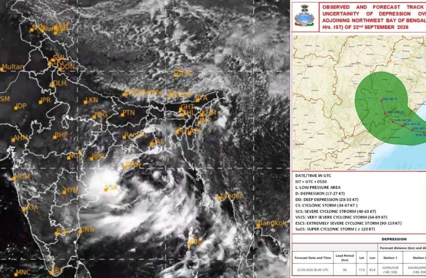
Odisha and Andhra Pradesh are likely to bear the brunt of a weather system over the Bay of Bengal that is forecast to intensify into a deep depression and move towards the coast, the India Meteorological Department (IMD) said.The system is expected to bring heavy to very heavy rainfall and strong winds to parts of the two states as it moves west-northwestwards.The IMD has forecast that the deep depression will cross the north Andhra Pradesh-south Odisha coasts between Visakhapatnam and Gopalpur during the night of September 23 and the early hours of September 24. OdishaOdisha is expected to be among the worst-affected states, with heavy rainfall already reported in several parts. The weather system has prompted authorities in several districts to shut schools and prepare for possible flooding and other weather-related incidents.Also Read: Cyclone ‘Arnab’ to form? IMD warns of deep depression, shares landfall update; Odisha schools shutKhurda, Jagatsinghpur, Ganjam and Gajapati have announced school closures, while Malkangiri has ordered schools to remain closed until September 24. Anganwadi centres have also been shut until September 24.The administrations have also taken several precautionary measures, including preparing shelters and restricting movement on vulnerable routes. Ferry services between Satapada and Jahnikuda in Chilika Lake have been suspended until September 25.The IMD has issued a red alert for parts of southern Odisha. Koraput, Gajapati and Ganjam are expected to receive heavy to very heavy rainfall, with extremely heavy rain possible at isolated places on September 23-24. Kalahandi, Nabarangpur, Koraput and Malkangiri are under red alert for September 24-25.Odisha Chief Secretary Anu Garg said collectors of 11 districts have been put on high alert amid forecasts of heavy to very heavy rain and possible waterlogging, urban flooding, landslides and mudslides."We have been informed by the IMD that the system could intensify into a deep depression, but not a cyclone," the chief secretary said, adding that the government has put required personnel ready to handle extremely heavy rainfall.Andhra PradeshThe depression is also expected to affect coastal Andhra Pradesh, with the system forecast to cross between Visakhapatnam and Gopalpur.The IMD said the depression was around 320 km from Visakhapatnam and was moving west-northwestwards. It is expected to intensify into a deep depression over the west-central and adjoining northwest Bay of Bengal before crossing the coast.The weather office has warned of squally weather and strong winds along and off the south Odisha-north Andhra Pradesh coasts. Winds may gust up to 75 kmph between the morning of September 23 and evening of September 24.Cyclone ‘Arnab’?The next cyclone to form over the North Indian Ocean would be named Arnab, according to the roster that lists names of cyclonic storms.However, the IMD has currently forecast that the system will intensify into a deep depression, rather than a cyclone. Odisha Chief Secretary Anu Garg also said the weather office had informed the state government that the system was not expected to become a cyclone.The IMD said the system is likely to continue moving west-northwestwards before crossing the north Andhra Pradesh-south Odisha coast between Visakhapatnam and Gopalpur.(With PTI inputs)